File:Afghanistan-970-religious-map-Indopedia.png
Size of this preview: 588 × 599 pixels. Other resolution: 1,030 × 1,050 pixels.
Original file (1,030 × 1,050 pixels, file size: 201 KB, MIME type: image/png)
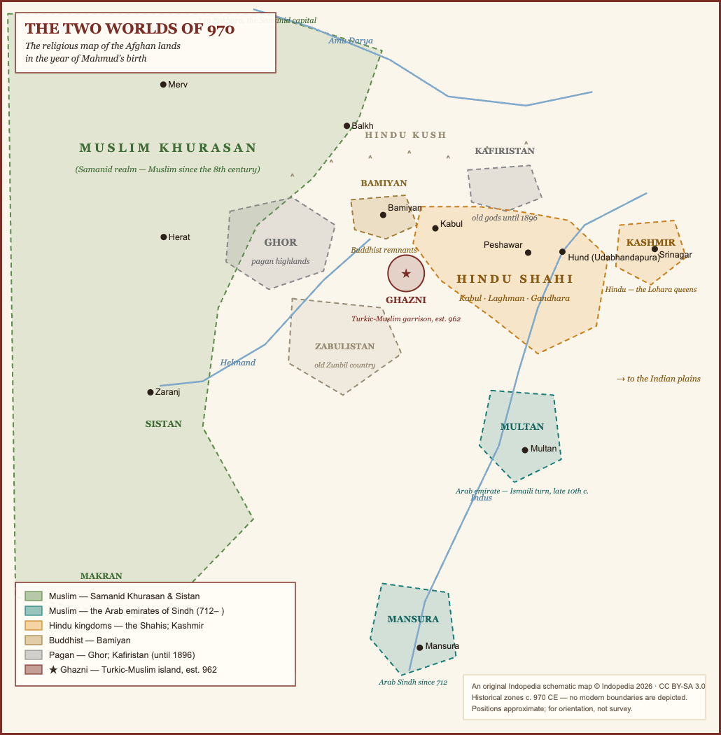
An original Indopedia schematic map: the religious landscape of the Afghan lands c. 970 CE. Historical zones only; no modern boundaries are depicted. (c) Indopedia 2026, CC BY-SA 3.0.
File history
Click on a date/time to view the file as it appeared at that time.
| Date/Time | Thumbnail | Dimensions | User | Comment | |
|---|---|---|---|---|---|
| current | 12:28, 12 June 2026 | | 1,030 × 1,050 (201 KB) | Bbnanawati (talk | contribs) | Original Indopedia schematic: the two worlds of 970 - religious map of the Afghan lands at Mahmud birth |
You cannot overwrite this file.
File usage
The following 2 pages use this file: