File:Jyotirlingas-map-Indopedia.png
Size of this preview: 800 × 593 pixels. Other resolution: 1,080 × 800 pixels.
Original file (1,080 × 800 pixels, file size: 152 KB, MIME type: image/png)
Summary
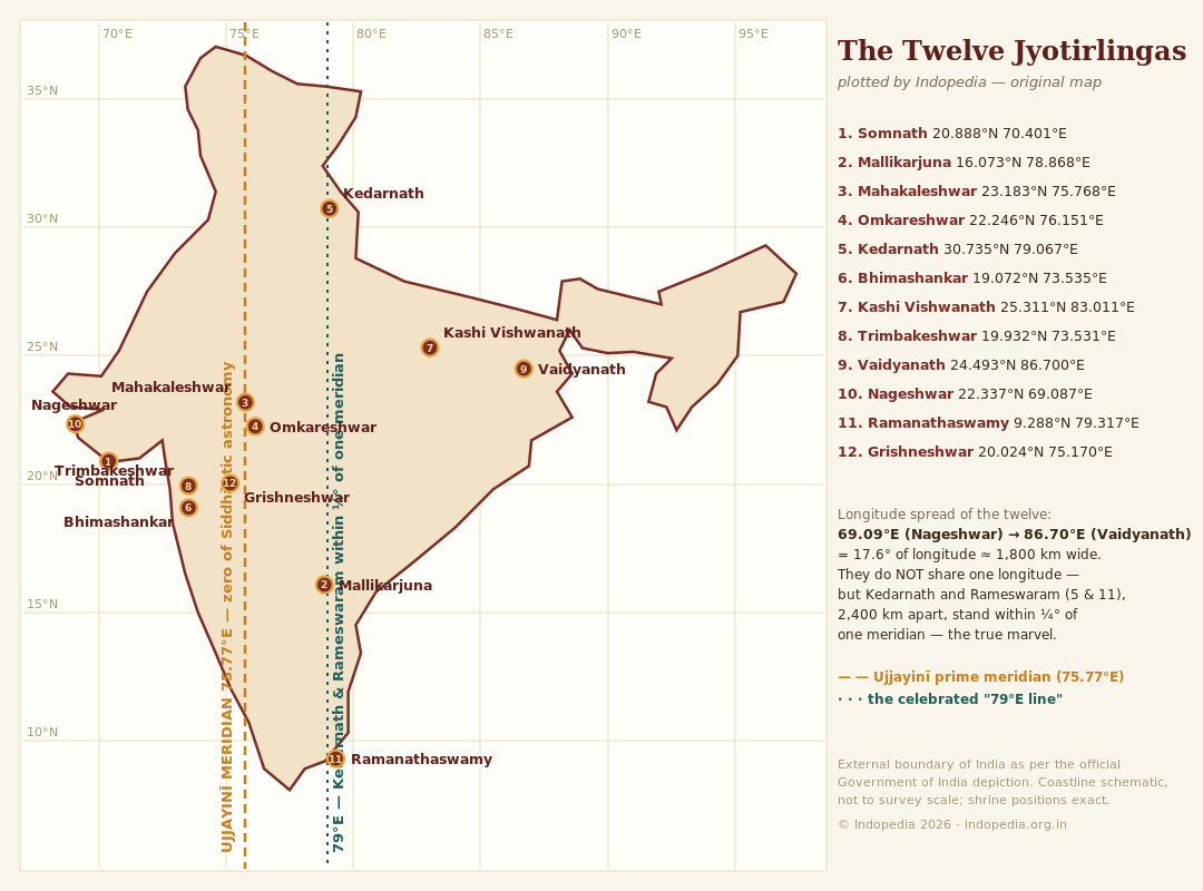
The Twelve Jyotirlingas — original Indopedia map (2026), plotted from coordinates. External boundary of India follows the official Government of India depiction (J&K shown in full). Coastline schematic, not to survey scale; shrine positions exact. © Indopedia — original drawing, not derived from any existing map.
File history
Click on a date/time to view the file as it appeared at that time.
| Date/Time | Thumbnail | Dimensions | User | Comment | |
|---|---|---|---|---|---|
| current | 08:55, 12 June 2026 | | 1,080 × 800 (152 KB) | Bbnanawati (talk | contribs) | The Twelve Jyotirlingas — original Indopedia map (2026), plotted from coordinates. External boundary of India follows the official Government of India depiction (J&K shown in full). Coastline schematic, not to survey scale; shrine positions exact. © Indopedia — original drawing, not derived from any existing map. |
You cannot overwrite this file.
File usage
There are no pages that use this file.