File:Waihind-Nagarkot-route-Indopedia.png

Size of this preview: 800 × 589 pixels. Other resolution: 872 × 642 pixels.
Original file (872 × 642 pixels, file size: 92 KB, MIME type: image/png)
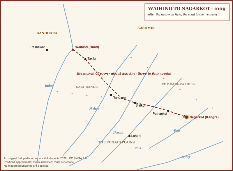
Original Indopedia schematic map of the 1009 march from Waihind (Hund) to Nagarkot (Kangra). Positions approximate; rivers simplified; no modern boundaries depicted. (c) Indopedia 2026, CC BY-SA 3.0.
File history
Click on a date/time to view the file as it appeared at that time.
| Date/Time | Thumbnail | Dimensions | User | Comment | |
|---|---|---|---|---|---|
| current | 18:07, 12 June 2026 | | 872 × 642 (92 KB) | Bbnanawati (talk | contribs) | Original schematic: the road from Waihind to Nagarkot, 1009 |
You cannot overwrite this file.
File usage
The following page uses this file: