File:Jyotirlingas-map-official-base.png
Size of this preview: 754 × 600 pixels. Other resolution: 1,409 × 1,121 pixels.
Original file (1,409 × 1,121 pixels, file size: 491 KB, MIME type: image/png)
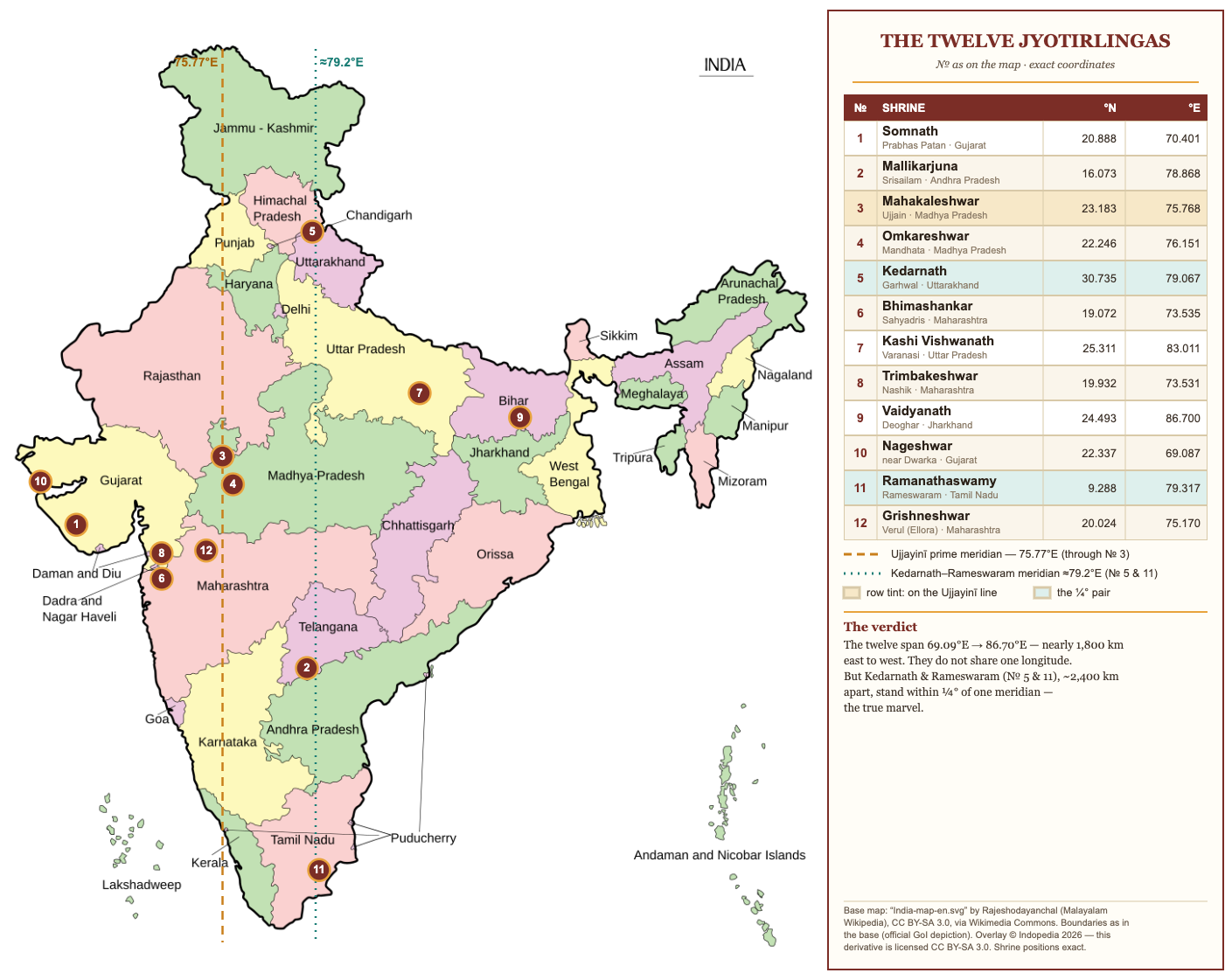
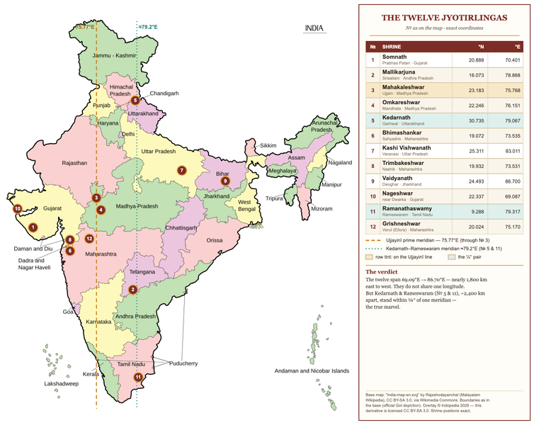
Twelve Jyotirlingas on the official-depiction India map. Base: India-map-en.svg by Rajeshodayanchal (ml.wikipedia), CC BY-SA 3.0; overlay (c) Indopedia; derivative CC BY-SA 3.0.
File history
Click on a date/time to view the file as it appeared at that time.
| Date/Time | Thumbnail | Dimensions | User | Comment | |
|---|---|---|---|---|---|
| current | 10:09, 12 June 2026 | | 1,409 × 1,121 (491 KB) | Bbnanawati (talk | contribs) | v2: side panel redrawn as a ruled table (No/shrine/N/E); teal line set to the Kedarnath-Rameswaram meridian ~79.2E |
| 09:46, 12 June 2026 | 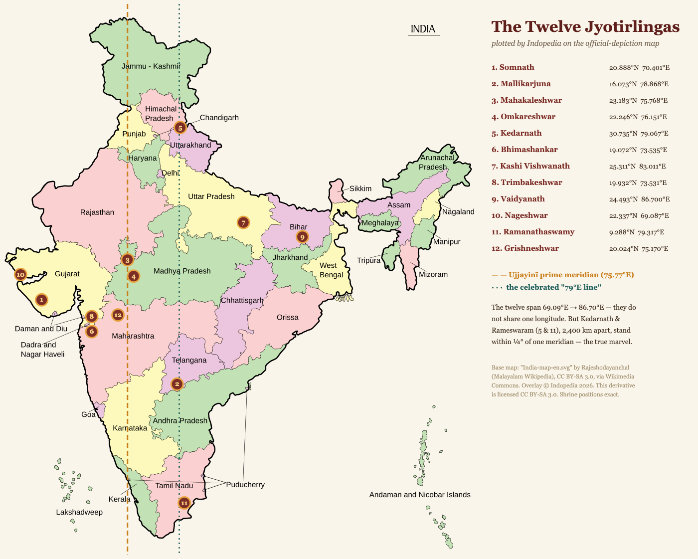 | 1,400 × 1,121 (424 KB) | Bbnanawati (talk | contribs) | Twelve Jyotirlingas on the official-depiction India map. Base: India-map-en.svg by Rajeshodayanchal (ml.wikipedia), CC BY-SA 3.0; overlay (c) Indopedia; derivative CC BY-SA 3.0. |
You cannot overwrite this file.
File usage
The following page uses this file: