File:India-resistance-era-map-Indopedia.png

Size of this preview: 585 × 599 pixels. Other resolution: 1,054 × 1,080 pixels.
Original file (1,054 × 1,080 pixels, file size: 237 KB, MIME type: image/png)
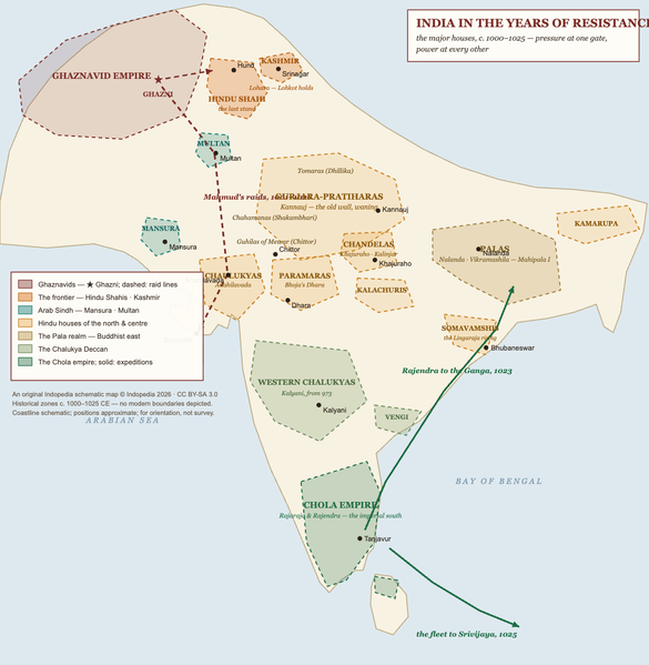
An original Indopedia schematic map: the major Indian houses c. 1000-1025 CE, with Mahmud raid lines and the Chola expeditions. Historical zones only; coastline schematic; no modern boundaries depicted. (c) Indopedia 2026, CC BY-SA 3.0.
File history
Click on a date/time to view the file as it appeared at that time.
| Date/Time | Thumbnail | Dimensions | User | Comment | |
|---|---|---|---|---|---|
| current | 13:14, 12 June 2026 | | 1,054 × 1,080 (237 KB) | Bbnanawati (talk | contribs) | Original Indopedia schematic: India in the years of resistance, c. 1000-1025 |
You cannot overwrite this file.
File usage
The following page uses this file: